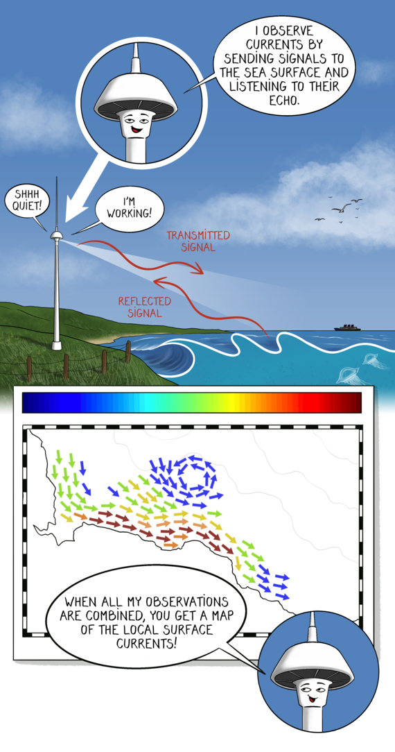
High-Frequency radars
What is a high-frequency radar?
A high-frequency radar is a fixed installation, based on land at shore. It maps ocean surface currents and wave fields, along with other variables, over wide areas. Taiwan Island was the first nation to have a radar network covering its entire coastline. Since then, about 400 radars were installed in 36 countries around the world.
Radar is an acronym for radio detection and ranging. It is a system that uses radio signals for finding the exact position of something.
How does it work?
A radar sends an electromagnetic pulse, a kind of energy wave, to a target. The target reflects the pulse and a small portion of the reflected energy returns to the radar. This returned energy is called an echo. The radar then uses the echo to determine the direction and distance of the target.
To measure the speed of surface currents, the radar uses the slight change in frequency when the target, here a moving water particle, reflects the electromagnetic wave. This physics principle is called the Doppler shift.
High-frequency radars are long-lasting and cost-effective. They don’t require much manpower and money for maintenance. Their downside is that they depend on radio frequency allocation and cooperation to run without interference, since radio waves are widely used.
What kind of ocean observations are collected?
- Surface currents
- Wave height
- Wave direction
- Wave period
- Wind direction
What are the observations helping with?
Here are some examples of how the information gathered can be used.
Operational services
All the information gathered by radars help map out ocean circulation (fronts and eddies, waves and surface wind, upwellings, etc.). This is useful for weather forecasts and marine forecasts, as well as tidal predictions. It also helps understand the coastal currents.
When extreme events happen, this information allows for early warnings and enables a more efficient hazard response.
The information is also valuable for maintaining safety at sea, for example during oil spill management or search and rescue operations.
An upwelling occurs when deep, cold waters rise to the surface along a coastal shore.
Climate change
Ocean circulation is affected by climate change. Understanding ocean circulation and sea-air interactions helps with climate research, monitoring and prediction.
Where can we find it?
On the coastline, all around the world.
High-frequency radars key numbers
- Number of radars: 400
- Number of countries involved: 36
- HF radar global network starting year: 2011
Learn more about high-frequency radars
The Global High Frequency Radar Network was established at the Group on Earth Observation (GEO)-VIII plenary in Istanbul in 2011. The network is still developing.
If you want to learn more about this program, visit the Global HF radar website.

