Moored buoys - DBCP
What is a moored buoy?
A moored buoy is an oceanographic instrument designed to stay in one place. It is anchored to the seabed by using recycled train wheels. It has to be replaced or maintained almost every year. Different models of buoys exist, varying in size and shape, depending on the expected sea state conditions, on the water depth and the type of measurements required. Most buoys are deployed by commercial ships and research vessels.
Moored buoys – including coastal, national moored buoys and tropical moored buoys - are part of the international Data Buoy Cooperation Panel (DBCP) program.
How does it work?
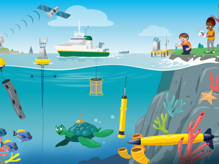
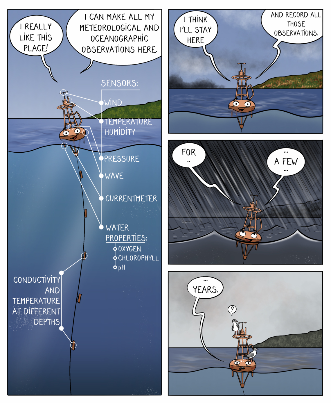
Scientific instruments can be attached to the mooring line, mounted on a surface buoy, or made to climb up and down the underwater line.
Above the water, moored buoys can be mounted with meteorological sensors, communications systems (such as satellite or radio transmitters and receivers), and solar panels.
Below the water line, buoys can hold many different instruments, including currentmeters, temperature and pressure sensors, and sediment traps.
Atmospheric pressure is the air pressure in a specific location. Low air pressure is called a depression and usually comes with rain.
What kind of ocean observations are collected?
The main observations gathered are:
- Air temperature
- Sea surface temperature
- Sea level atmospheric pressure
- Wind direction and speed
- Relative humidity
- Wave height and period
Some buoys also gather carbon content observations.
What are the observations helping with?
Here are some examples of how the information gathered can be used.
Operational services
Moored buoys provide information useful for global to regional weather forecasts, including extreme events, marine forecasts, monitoring ocean circulation (currents, tides, waves, etc.) and feeding data models of the ocean.
Their observations are also valuable for assisting fisheries and ensuring safety at sea, for example during search and rescue operations.
Climate change
The information is used for climate research, ocean monitoring and prediction. Some of the coastal and national moored buoys have been in place for at least a couple of decades, some for as long as 40 years, and so provide valuable time-series for ocean and climate studies.
Ocean health
Some buoys gather observations on ocean carbon storage. It helps with monitoring ocean acidification. This threatens marine life by making it difficult to grow shells and affects fish behavior. Other buoys can monitor oxygen content in the ocean, which is also influenced by climate change.
The ocean stores a lot of carbon, by absorbing atmospheric CO2 and dissolving it. Monitoring its carbon content is crucial to measure how much it can hold, and for how long.
Where can we find it?
Moored buoys are deployed both in coastal areas and high seas.
Moored buoys key numbers
- Size range of a buoy: 2m- 12m
- Number of buoys: 309
- DBCP starting year: 1985
Learn more about moored buoys
Coastal and national moored buoys are operated by a wide variety of organizations such as National Meteorological and Hydrological Services, marine and oceanographic institutes, etc.
The tropical moored buoys array provides information in real-time for climate research and forecasting. Major components include the TAO/TRITON array in the Pacific, PIRATA in the Atlantic, and RAMA in the Indian Ocean.
If you want to learn more about this program, visit the DBCP website.

